Kodagu is an administrative district in Karnataka State in southern India. It is also known by its anglicised former name of Coorg. It occupies an area of 4,102 square kilometres (1,584 sq mi) of land in the Western Ghats of southwestern Karnataka. As of 2001, the population was 548,561, with some 13.74% of the population residing in the district's urban centres.
Madikeri is the headquarters of the Kodagu district. The district is bordered by Dakshina Kannada district to the northwest, Hassan district to the north, Mysore district to the east, the Kannur District of Kerala to the southwest, and the Wayanad District of Kerala to the south.
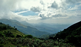
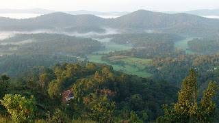
Kodagu is located on the eastern slopes of the Western Ghats. It has a geographical area of 4,102 km2 (1,584 sq mi). The district is bordered by Dakshina Kannada district to the northwest, Hassan district to the north, Mysore district to the east, the Kannur District of Kerala to the southwest, and the Wayanad District of Kerala to the south. It is a hilly district with the lowest elevation in the district at 900 metres (3,000 ft) above sea-level. The highest peak, Tadiandamol, rises to 1,750 metres (5,740 ft), with Pushpagiri, the second highest, at 1,715 metres (5,627 ft). The main river in Kodagu is the Kaveri (Cauvery). The Kaveri starts at Talakaveri, located on the eastern side of the Western Ghats, and with its tributaries, drains the greater part of Kodagu.
In July and August, rainfall is intense, and there are often showers into November. Yearly rainfall may exceed 4,000 millimetres (160 in) in some areas. In dense jungle tracts, rainfall reaches 3,000 to 3,800 millimetres (120 to 150 in) and 1,500 to 2,500 millimetres (59 to 98 in) in the bamboo district to the west. Kodagu has an average temperature of 15 °C (59 °F), ranging from 11 to 28 °C (52 to 82 °F), with the highest temperatures occurring in April and May. The principal town, and district capital, is Madikeri, or Mercara, with a population of around 30,000. Other significant towns include Virajpet (Virarajendrapet), Kushalnagar, and Somwarpet. The district is divided into the three administrative talukas (divisions) of Madikeri, Virajpet and Somwarpet.
How to Reach Coorg
By Air: The nearest airport is Mysore Airport which is 120 KM away and Mangalore International Airport around 180 km away. Private taxies & buses are easily availble from here to reach Coorg.
By Rail: The nearest railway stations from Coorg are Thalassery, Mysore and Hassan.
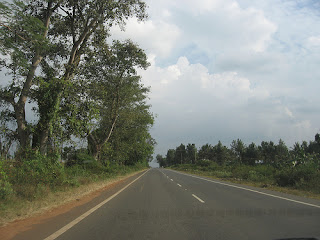
By Road: Coorg is very well connected by road to the major cities of India.
Below are some important distance from Coorg:
Coorg to Mysore - 120 km
Coorg to Hassan - 115 km
Coorg to Mangalore - 135 km
Coorg to Bangalore - 250 km
Best Time to Visit Coorg
November to April is the best time to visit Coorg.
Map of Coorg
Coorg Weather
Places to visit in Coorg
Talakaveri
Talacauvery, is the place that is generally considered to be the source of the Cauvery River. It is located in the Brahmagiri hill (not to be confused with the Brahmagiri range further South) near Bhagamandala in Kodagu district, Karnataka, 1,276 m. above sea level. However, there is not a permanent visible flow from this place to the main rivercourse except during the rainy season.
A tank or kundike has been erected on a hillside, at the place that is said to be the origin. It is also marked by a small temple, and the area is frequented by pilgrims. The Kaveri River originates as a spring feeding this tank, which is considered to be a holy place to bathe on special days. The waters are then said to flow underground to emerge as the river some distance away. The temple has been renovated extensively by the state government recently.
On Tulasankramana day (the first day of Tula Masa month, according to the Hindu calendar, which normally falls in mid October) thousands of pilgrims flock to the river's birthplace to witness the rise of the fountainhead, when water gushes up from the spring at a predetermined moment. The tula snanam (Sacred bath in the Tula month) is observed across pilgrim towns in Kaveri's banks.
Talacauvery is about 8 km away from Bhagamandala and 48 km from Madikeri.
Irupu Falls
The Irupu Falls (also Iruppu Falls) are located in the Brahmagiri Range in the Kodagu district of Karnataka, India, bordering the Wayanad district of Kerala. It is a fresh water cascade and is situated at a distance of 48 km from Virajpet on the highway to Nagarhole. The Falls are also known as the Lakshmana Tirtha Falls, derived from the name of the tributary of Cauvery which starts from these falls, the Lakshmana Tirtha River.
A forest trail leads from these falls to the Brahmagiri Peak in Southern Kodagu. Irupu falls is a major tourist attraction as well as a pilgrimage spot. A famous Siva temple, the Rameshwara Temple is situated on the banks of the Lakshmana Tirtha River, en route to the Falls. This temple attracts a large number of pilgrims during the festival of Shivaratri.
Abbey Falls
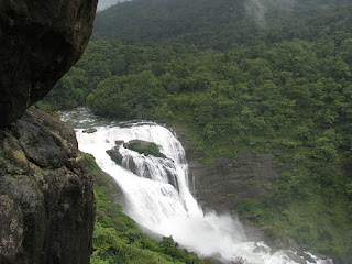
 Abbey Falls (also spelled Abbi Falls and Abbe Falls) is in Kodagu, in the Western Ghats in Karnataka, India. It is located 8 km from the town of Madikeri and 268 km from Bangalore.
In the mountains of the Western Ghats, several streams combine, swelling with the monsoon rains and plunging down the mountain slope at enormous speed, hitting the huge boulders hard and forcing through the crevices and ravines. A misty cloud hangs over the falls. From here the water flows into the Kaveri River. During the monsoon season the water flow is very high. During the dry seasons the flow is considerably diminished.One can find a lot of leeches inside the water.
The waterfall is located between private coffee plantations with stocky coffee bushes and spice estates with trees entwined with pepper vines. The falls appear suddenly, the water cascading over rocks into calm pools. A hanging bridge constructed just opposite the falls comes in handy for the Tourists. There is a Kali Mata temple on the other side of the bridge and Coffee and Black Pepper trees on the other side.
Dubare
Dubare is known for its elephant camp, and is a forest camp on the banks of the river Kaveri in the district of Kodagu, Karnataka. It is an important base for the Karnataka Forest Department's elephants.
The elephants for the Mysore Dussehra were trained at Dubare elephant camp. At present, after logging operations have ceased, the elephants have been practically retired except for giving some rides to tourists.
In addition to elephant training camp, Nisargadhama and Veerabhoomi are the other main attractions of the forest area.
There are opportunities for trekking, elephant rides, fishing, and river rafting. these activities are hosted by Jungle Lodges and resorts. The Forest Department also conducts some treks along well-defined routes.
The moist deciduous forests of Dubare are home to many wild animals and birds. Sighting of wild Asiatic elephants are regular and so is spotting the sambhar and the spotted deer. tiger, leopard, wild dogs, gaur and bears are also seen in these forests. Crocodiles can be seen in river. The forests are also home to many reptiles non-venomous snakes.
Birdlife in Dubare includes peacock, partridge, kingfisher and woodpeckers topping the list.
Dubare is easily accessible from Bangalore. The route from Bangalore is via Mysore, Kushalanagara, Gudde Hosur (4km from Kushalanagara on BM Road), then turn towards Siddapura. About 15 kilometer on the Siddapura Main Road visitors would find a Dubare Camp board.
Chiklihole Reservoir Dam
The unique thing about this dam is the scenic way in which water is allowed out of the reservoir.Roads are decent, but not wide enough for buses.
Nagarhole National Park
Nagarhole National Park, also known as "Rajiv Gandhi National Park", is located 94 kilometers (58 mi) from Mysore in Karnataka in South India. It is spread between Kodagu district and Mysore district. Located to the north-west of Bandipur National Park, Kabini reservoir separates the two. The park has rich forest cover, small streams, valleys, and waterfalls. The park has a healthy tiger-predator ratio, and tiger, Indian bison, and elephant are much more populous here than in Bandipur.
The park stretches over 643 square kilometres (248 sq mi), protecting the wildlife of Karnataka. Together with the adjoining Bandipur National Park (870 km2 (340 sq mi)), Mudumalai National Park (320 km2 (120 sq mi)) and Wayanad Wildlife Sanctuary (344 km2 (133 sq mi)), it forms the largest protected area in Southern India, totalling 2,183 km2 (843 sq mi).
The park is part of the Nilgiri Biosphere Reserve. The Western Ghats, Nilgiri Sub-Cluster (6,000+ km²), including all of Nagarhole National Park, is under consideration by the UNESCO World Heritage Committee for selection as a World Heritage Site.
Bhagamandala
Bhagamandala is a pilgrimage place in Kodagu, Karnataka, in India. It is situated on the river Kaveri in its upstream stretches. At this place, the Kaveri is joined by two tributaries, the Kannike and the mythical Sujyoti river. It is considered sacred as a river confluence (kudala or triveni sangama, in Kannada and Sanskrit respectively).
It is a common practice for pilgrims to take a dip in the triveni sangama and perform rituals to their ancestors before proceeding to Talakaveri, the birthplace of Kaveri. During Tula Sankramana which falls on October 17th or 18th, pilgrims assemble here in large numbers.
Dargah Sharief of Yemmemadu
Dargah Sharief, the Holy Tomb, of Yemmemadu is one of the most sacred shrines for Muslims in Kodagu district. (35 km from Madikeri; Madikeri-Bettageri-Napoklu-Hale Taluku-Yemmemadu)
Mandalapatti
28 km from Madikeri. On the way to Abbey Falls, before 3 km from Abbey Falls take right, from there 25 km.
Hotels in Coorg
Solitaire Exotica Resort
Hotel Hill View
Hotel Rajdarshan
Hotel Hilltown
Green Lines Stays
Hotel Heritage Resort
Orange County Resort
Green Hills Estate
Hotel Capitol Village Resort
Kannika International
Alpen Glow Homestay
Hotel Polaycad Estate
Hotel Kadkani Riverside Resorts


